Glacier NP

Glacier NP

Marker for Camp Disappointment

Very close to where Lewis recrossed the Continental Divide on his return trip
We have spent the last 2 days driving around Montana, mostly in pursuit of L&C trail, and we also found some other interesting or entertaining sites.
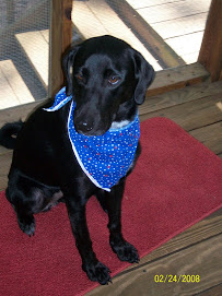
Entertaining: Great Falls has a Dog Park right on the River Road, and it is open to all dogs whose owners behave. Daisy and I went there yesterday and today before setting off on long car trips. She had so much fun! Barked at and chased other dogs and was chased and barked at. Nothing could be better! (She also wore out for a while and was a calmer car rider for a couple hours after each visit.)
Interesting: learning more about Native Americans including going to the Museum of the Plains Indians on the Blackfoot reservation today (on the way to Glacier NP). The museum is small and contains scores of artifacts of Plains Indian hand-work--clothes, tools, weapons. Truly beautiful stuff; reminded me of my Uncle Ole.
Glacier NP was our Point of Disappointment (you'll understand the reference later). I had been assured by locals in the know that the park's main road, the Road to the Sun, which traverses the park from east to west, would be open till at least October 1. However, I learned upon entering the park at St. Mary's Lake, that the road was closed beyond the Logan Pass Visitor Center--18 miles in (the road is 50 miles long). Nonetheless we drove in and saw some awesome sights--glaciers, snow, lakes, etc. I posted a ton of pics on Facebook. Then we turned around and drove back out and then around the outside of the park in order to get to Missoula as planned. Made for a long day of driving but was worth it.
On the way there, we stopped at the site that Lewis called Camp Disappointment. I need to backtrack on the history of the Expedition to explain... On the return journey, Lewis and Clark agreed that there was so much to explore in Montana beyond their single-minded focus on the Missouri (which was their strict order from Pres. Jefferson), that they would split the Corps at Travelers' Rest (in western Montana; we'll be there in 2 days, so more on it later) and reunite at the junction of the Yellowstone and Missouri Rivers in far eastern Montana. The expanse to cover was almost 500 miles, but their various detours meant that Clark covered about 1,000 miles and Lewis almost 800. Clark went south, finding the Yellowstone and following it downstream to where it joined w/ the Missouri.
Lewis went North, first taking a short cut across the Continental Divide that they had learned about from the Indians, then going back to Great Falls. He left some men there to dig up what they had cached on the way up, and then he headed up the Marias river with the rest of his group. He hoped to determine that the Marias came from North of the 50th parallel, thus extending the US border further north than currently known. (The Marias was the river that came into the Missouri shortly before Great Falls where they had their Decision Point...see previous blog.) In following the river north and west, he learned it went more west than north and so he was not able to move the US boundary--thus he named their northenmost camp Camp Disappointment. During this trek they also encountered a small band of Blackfeet and had the only violent encounter of the Expedition. They survived and proceeded back to the Missouri to meet up with the rest of their group and then later with Clark & Co. (There were other side trips made by both captains...I won't bore you with it all.)
So that was today. Yesterday we followed L&C trail west from Great Falls to Gates of the Mountains and to near where they found the headwaters (see previous post on Three Forks). Then we headed north to pick up Lewis's return trail and went back to Great Falls. In this day we crossed the Continental Divide several times.
This whole Continental Divide thing has me wondering...do other continents have continetnal divides? I know there is another one in eastern US--along the Appalachians. And here in Montana in Glacier NP the divide is actually three-way: some rivers run to Mississippi (like Missouri River); others to the Pacific (we'll be getting to those soon), and still others to Hudson Bay.
I must say that until I started really following the L&C trail I had little understanding of the geography of the US West. I have learned so much, and seen much beauty and many varying landscapes. The journey becomes more amazing every day as I see how truly daunting were the obstacles they faced!
Tomorrow we'll back track for the last time to where they first tried to cross the Bitterroots. Should be an awesome day!


I for one am really enjoying the reading and the concise history lessons you are providing. Yes, you should be a teacher. It is amazing to me how in the time of L&C they could part ways on their journey and plan to meet up again and do so some 800-1000 miles later. What does that say for the need to have GPS? Not much I suppose.
ReplyDelete