Decision Point. As they head West on the Missouri, a river appears coming in from the North. Lewis named it Marias River (after his cousin). In the pic, I am looking east, so Marias is the water on the left.

Near Fort Benton, MT. You can see how the bluffs come all the way to the river. Lewis noted that this was a frequent occurrence and made the traveling upstream even harder.

Big Sky Country

The top map shows the Rockies and L&C thought them to be (aided by inaccurate reports/translation from the Native Americans); and below is how they actually are. More on tis in future blogs!

Three Forks, or headwaters of the Missouri. The Gallatin, Madison, and Jefferson rivers converge to form the Missouri. It's pretty early, so you can see my and Daisy's shadows.
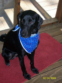
We started the day early and drove to Missouri Headwaters State Park, also known as the Three Forks area, where Lewis and Clark noted that 3 rivers came together and formed the Missouri. Daisy and I walked a number of trails and got some great pics.
Then we drove north and east, and backward in L&C time to Loma, MT, where the Marias River comes in from the North and the Corps was stumped as to which was the "real" Missouri. This area is known as "Decision Point." There Lewis took a few men and explored the northern river (which he later named Marias River) and Clark and some men explored further up the Missouri. When they came back together, all the men in the Corps were certain the northern river was the real Missouri, but the captains believed it was the southern -- and they were right. From there we drove south through now-Fort Benton to the Great Falls. It took Lewis and men 3 days on horseback and Clark and the rest via the Missouri 6 days to cover what we did in just over an hour.
On our way from Three Forks to Loma, we drove through some beautiful country, including the Lewis and Clark National Forest. From there we rose to high plains like those L&C traveled through, and saw how sharply the bluffs from the plains close down on the Missouri River. While up on the plain, it is clear why they call this Big Sky Country. My relatives in West Texas may disagree, but now I have seen both places, and the sky actually seems even bigger here than in West TX. Another thing to note about Montana: Interstate speed limits are 75 mph, and state highway 70--wow--too fast to see all there is to see! And at the ends of ramps on and off Interstates, there are cattle guards--I guess I wouldn't want to see a cow at 75 mph!
All in all, a good day. I keep struggling with our itinerary...and as of right now I believe we sill drove to Glacier NP tomorrow, stopping aong the way to see a couple of L&C sites as well as some significant American Indian sites and museums. It will be a long day, so we'll make Thursday a local day--to see all there is to see in Great Falls (and do laundry) before leaving Friday for points West, following the L&C trail. From here, with a couple of exceptions, we'll be on L&C trail to the Pacific.


No comments:
Post a Comment