Thursday, October 29, 2009

New Orleans


Causeway over Lake Ponchatrain


Tree decorated with Mardi Gras beads in the Garden District

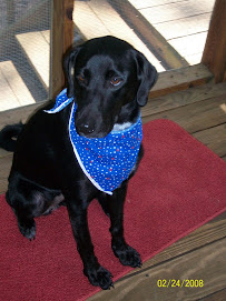
Unc, Daisy, and I have had a good couple of days in New Orleans. Daisy has coped with city life quite well, being patient to walk a couple of blocks before doing her duty, etc.

We spent most of yesterday morning at the World War II Museum, originally started as the D-Day Museum by Stephen Ambrose. There are some great exhibits, and all veterans are warmly welcomed by a staff of volunteers. Unc met a couple of men who also served in Naval Aviation in the mid-1960s.

We spent the afternoon driving south on La23 to the delta. Lots of water everywhere!

In the evening Unc and I went to Bourbon Street for a quick drink and look around before it got too crazy!

Yesterday we finally made it to Cafe du Monde--love those beignets and cafe au lait! We also hit Jimmy Buffett's Margaraitaville store and restaurant--bought some Christmas presents. We spent the afternoon driving around the garden District then north along Lake Pontchatrain to its north side then driving the 24-mile causeway back to the city. It's anazingly large, and in the middle of the causeway, you feel as if you could be in the middle of nowhere.

A quiet night last night--needed to rest! Today we are off to Pensacola, FL, via the beaches in Mississippi and Alabama--Daisy's gong swimming!

Monday, October 26, 2009

Travels with Daisy and Unc

It all started at 3:45 a.m. (CDT). Yep. Unc banged on my door and said "we gotta hit it..storm's a'coming and we need to get ahead of it." So our 6 am departured became a 4:12 a.m. departure. Thank goodness we had packed 90% of the trunk and car the evening before.
Unc drove the first 2.5 hours (in the dark, of course) and then I took over while it was still dark, about 45 miles west of Houston. Boy were the next 2 hours fun! Rush-hour traffic, tremedous downpurs, lightning flashes, and Daisy trying to get in the front and sit on our laps. But we made it, and soon left the rain and storms behind us.
Shortly after we got into Louisiana, we left the Interstate and drove through a lot of southern Louisiana. Really interesting area--lots of sugar cane fields. Very little traffic. We got into New Orleans about 4:15--so a 12-hour day but most of it nice. It'll be early to bed tonight!

Sunday, October 25, 2009

On the road again...

Today (Sunday) is our last day in Austin. We're going to be gone a while, heading a couple hours northwest to meet some family from Abilene for lunch (we're meeting them halfway) since the outbreak of flu there kept me from visiting last weekend. Then Unc and I (and of course Daisy)head to New Orleans tomorrow. The world's most spoiled dog has had a marvelous time here playing with Molly. She got a much-needed bath yesterday and is sitting in the car right now, pretending to go for a car ride. More tales from the road to come....

Tuesday, October 20, 2009

We're back!


Daisy and Molly B


Sunrise south of Lubbock


Cadillac ranch on Route 66 outside Amarillo


I haven't blogged for almost a week. Sorry! Daisy and I thoroughly enjoyed New Mexico, and I just posted some more pics on FB. One of the most interesting stops we made was at Pecos National Historical Site, which among other things is the site of a Civil War battle, known as the Gettysburg of the West. Until I took this trip, I had no idea there was so much Civil War activity in the western states.

On Friday we took a long route to Amarillo, where we planned to stay overnight before heading to Abilene to see family. Unfortunately, the flu arrived in Abilene before I did and my aunt called just as I pulled into Amarillo to suggest I not come there. So we ducked into the nearest La Quinta, which was not the one at which we had a reservation, and a very helpful desk clerk canceled my reservation in Amarillo and made one for me in Lubbock, 2 hours south.

So we headed into 5 pm traffic in Amarillo and went to Lubbock to spend the night. Then we got up very early and drove hell-for-leather to south Austin, successfully arriving before the end of the first half of the TX-OU football game (this is a VERY BIG DEAL in these parts). The rest of Saturday and Sunday were spent hanging out with family and friends--and introducing Daisy to MollyB, my uncle's 8-month-old golden retriever. They are getting aong so well! And are very tired puppies every night, which is good stuff.

Yesterday and today have bene spent on mundane things like getting the windshield repaired and tires replaced on Daisy's car. I also had it thoroughly cleaned. Later today we are heading south to San Antonio to see the Alamo and have dinner with a friend. On Monday, Unc and I leave--with Daisy of course--for adventures in New Orleans and other points east of here.

Wednesday, October 14, 2009

Pictures from the past week


A look at the Grand Canyon from the south rim


Dinsosaur tracks


Sunrise over Lake Powell

Daisy looking over the cliff at Hovenweep

One of the ancient structures at Hovenweep


A kiva in Canyons of the Ancients


The square tower bulidings in Mesa Verde


Daisy and I got to Albuquerque yesterday. We didn't go to some of the places I had hoped due to snow at higher elevations--and I was tired after the thunderstorms the night before (Daisy woke me up at 2 am). So for today I thought I would post some pics from previous days when I couldn't post any pics.

Monument valley


Monument valley


Four Corners


Four Corners

Monday, October 12, 2009

Ancient Puebleans--aka, Anasazi

Much of the past 2 days we've driven all around the Four Corners area of the US and seen lot sof interesting terrain, ancient homes, etc. And I've changed time zones and crossed state and reservation lines so often I am dizzy! Unfortunately, the WiFi connection here is bad, so I hope I can post even this short post. I'll get into more detail when I have a better connection. Heading to NM tomorrow--Albuquerque!

Saturday, October 10, 2009

Northeastern AZ

We got up early (thanks, Daisy) and went for a walk near Lake Powell at dawn. Later we drove through the Painted Desert and stopped at several spots on the Navaho Reservation. A very interesting one was the Dinosaur Tracks 5 miles east of Tuba City. This website tells you more (I found the website after seeing the tracks): http://www.roadsideamerica.com/story/11499.

A knowledgable Navaho man who lives nearby showed me around, asking politely and non-aggressively for a donation/tip for his time. Daisy enjoyed traipsing around this mesa area of stone and real dinosaur tracks and so did I. I also succumbed to buying some jewelry at a nearby stand--they line the roadways on the reservation.

Next we headed south then west to Desert View--the farthest west part of the South Rim of the GC. I thought about going further into GC NP, but there were too many people! Still, the view was spectacular, and I know I must come back to spend some serious time at GC. Having seen a tiny bit of South Rim, I think the people are right who say North Rim is even better. (Harder to get too also, so fewer people--always a plus for me. Am I turning into a curmudgeon? If so, I get it naturally from dear old dad.)

We were back to Page by about 3 pm and now are watching the Texas-Colorado game. The Iowa-Michigan game starts soon; I hope they carry it here as a lot of family and friends are there in the cold and snow. Go Hawkeyes and Hook 'Em Horns! Oh, and the Tar Heels won today!

Once again I cannot post pics--sorry; see FB

Friday, October 9, 2009

Grand Canyon


Vermilion Cliffs


Grand Canyon, from Point Imperial


At Point Imperial

Daisy and I got an early start, leaving our hotel just before 7 am (about 30 minutes before sunrise). We headed East then South and fairly soon crossed into Arizona, where I was reminded that Arizona is ALWAYS on Mountain Standard Time, which right now is the same as Pacific Daylight Time, so it was an hour earlier there. Which would have been OK but I had hoped to go to the Pipe Spring National Monument, but it didn't open till 8 and we were there at 7:15. Oh well.

We continued south across an area called the Arizona Strip and then onto the Kaibab Plateau. This is a large, high desert (about a mile high) that ends at the North Rim of the Grand Canyon. As we got close to the GC, we crossed though an area that was ravaged by fire in 2000 and then onto a high meadow area. I saw a wild turkey and several deer in the meadow area.

Then I crossed into GC NP and drove to the visitor center, where the Grand Canyon Lodge is also located. I took the Bright Angel Point Trail from here to my first view of GC. Amazing. Words and even pictures cannot capture this place. I'll try to post a few pics here, and I put a bunch on FB. The Lodge is also incredible and this is one place I am definitely coming back to spend some more time
We drove to all the other major (non-trail-accessed) viewpoints on the North Rim, and it just kept getting better and more awe inspiring. There were a lot of people but it didn't feel as crowded as Bryce Canyon. All in all, we spent almost 5 hours there, and I feel like I've barely "tasted" it.

Earlier in my trip I spoke to a number of people about the GC and most recommended North Rim over South, so I am glad I went to North Rim. It also allowed me to plan the next parts of my trip, including the rest of this afternoon. We drove along and then through the Vermilion Cliffs and crossed the Colorado River. It was getting late so I didn't stop at Marble Canyon, but will go back tomorrow on our way to the Painted Desert. We are spending tonite and tomorrow nite in Page, AZ, near Lake Powell. There's a lot to see around here so tomorrow will be another long (and good) day.

On a personal history note, Lake Powell is named for John Wesley Powell who was the first to fully explore and map the Colorado River region and travel throught the Canyon (he also named Marble Canyon, among other places). My father once taught a class that included reading and examining the book Powell wrote (The Exploration of the Colorado River and Its Canyons). I was privileged to be able to sit in on that class and see what a great classroom teacher he was (I already knew he was a good dad-teacher). Years later in college, a Classics professor included this book in a class called "The Heroic Journey," which also included the Iliad and the Odyssey, Sir Gawain and the Green Knight, and parts of Chaucer's Canterbury Tales. I only wonder (now) why he did not include the journals of Lewis and Clark in this class.

Thursday, October 8, 2009

Southwest Utah

I have always been told that Utah is a beautiful state. Prior to this trip I had been here only once, on a quick business trip to Salt Lake City. I know on this trip I have seen only a portion of all there is to see, but what I have seen is spectacular!

Yesterday we drove to and through Bryce Canyon. To my great surprise, there were scads of people there, busloads, literally. Far more than I saw, for instance, at Glacier NP. Too many. The overlooks were crowded, and I couldn't go on trails with Daisy, so I know I didn't see all I wamted to see. But what I did see was amazing. There are thousands of rock formations called hoodoos that are unique and hard to describe.

From there we took a very scenic route to the edge of Zion Park. It started raining, which is unusual here, and then I found out that we couldn't drive through the actual park; it is accessible only by tour bus, and they don't allow dogs. There is one trail we could have taken--they even allow dogs--but with the rain that wans't an option.

Today we drove to a northern part of Zion NP and saw some nice sights. Still nothing like what the interior must look like! As with other National Parks, this is one for a return trip without a dog (sorry, Daisy).

Speaking of the world's most spoiled dog, she is doing great. She charms people every where we go. There was a nice couple in Bryce Canyon who threatened to steal her--and even her obnoxious barking did not put them off!

Once again I cannot upload pictures...so see my postingson FB. Sorry.

We are off the to Grand Canyon tomorrow!

Tuesday, October 6, 2009

Geography Lessons

Daisy and I are in St. George, Utah. We will spend tomorrow driving to/from and in/around Bryce Canyon.

We've travelled 7,500 miles so far, and I've looked at lots of maps, used Google maps to plan parts of the trip, plugged in the GPS from time to time, and still had a lot of surprises and have learned a lot. My top 10 lessons:

Lesson 1: As L&C learned, the Rockies are WAY different from the mountains in the East. First of all, they are not one chain but multiple chains; second, they are WIDE. This leads to...

Lesson 2: Pay attention to topography. You need to know how high you are going and how the weather and road conditions differ at that altitude.

Lesson 3: Changes in altitudes, changes in attitudes (sorry, Jimmy Buffett): my first few days above a mile high really zapped me, and made a glass of wine very powerful! Since then I've gone up and down and feel fairly acclimated. But the other thing about altitude, especially in October, is SNOW. The best thing to do is talk to locals about weather conditions.

Lesson 4: GPS is great in traffic and to find your way back to your route when lost. Otherwise, it's annoying.

Lesson 5: I like wide-open places MUCH better than cities. That is one reason I nixed California to head through Oregon, back to Idaho, and into Utah. I pretty much avoided people/traffic from when I left home till Portland/Vancouver. Once again I can avoid all that till I get to Austin. Yeah!

Lesson 6: Wide-open spaces also mean wide-open speed limits: on the Interstates in the wetsern states in which I have travelled, speed limit is usually 75 mph, and in parts of Utah it is 80. Even secondary roads often have speed limits as high as 65 mph.

Lesson 7: Secondary (and tertiary) roads are usually better than Interstates--except when you are in Fed-Ex mode: you absolutely have to get there in a certain time frame.

Lesson 8: More on those wide-open roads and how they are different: there are cattleguards on Interstate ramps, which is good 'cause I'd hate to hit a cow; also semis pull three trailers in a row--would never be able to do that in eastern highways.

Lesson 9: Rest areas are nicer and cleaner in the West than back East--perhaps because of fewer users or maybe people are more respectful of others out here. On that note...less litter out here too. Maybe it's just fewer people in general.

Lesson 10: Stop at random historical markers and the like. You never know what you'll learn or what side trip you'll have an adventure on! I have vowed to to this as much as possible on this trip and it has paid off. I always wanted to...now I can and do!

Monday, October 5, 2009

History Odd and Ends

Today we drove from Caldwell, ID, to Provo, UT. Originally it was to have been an all-interstate trip just to cover some miles--generally NOT the way I prefer to travel. I have often said before and during this journey that I want to stop at any and all historical markers that catch my eye--and go to places advertised along the road that seem interesting. That approach has paid off so far and today led to a couple of very interesting places.
First was the Hagerman Fossil Beds National Monument. (As an aside, I learned the difference between a National Park, Monument, and Historical Site by listening to the Ken Burns book on the National Parks that accompanies the PBS series.) The park ranger there was super informative and pointed me to some other places to go as well as informing my visit there. (I also bought a cool gift for my nephew, the dinosaur lover.)
While there are no dinosaurs here or in the John Day area I visited yesterday, there are some incredible finds. But I am not a scientist. The name of the place caught my eye because of my nephew, so I drove about 15 miles out of the way to see what it was. Happily for me the historian, this is also a site of well-preserved Oregon Trail tracks and information as well as the source of information on a site further away: Minidoka National Historical Site.
While you are thinking about what that is, I'll take a bite of steak. I am so excited that my hotel is attached to a steak house, and I am having only my second steak of the trip and the first since visiting friends in Lander, WY. I've been across the Continental Divide a number of times since then--with at least one more crossing to come. I am hungry!
OK...Minidoka. What is it? It is one of TEN Japanese relocation centers/internment camps established after 12/7/41. If you are of my generation, I am sure you read the book, "Farewell to Manzanar." That basically started and ended my education about this misguided national security effort of the 1940s. Anyway, I had NO idea there were sites in states not on the Pacific Coast, and learned in fact that there were 2 in Arkansas. This site and the one at Manzanar are part of the NPS--I dont' know about the others. Speaking of NPS (National Park Service), 2 artists very instrumental in showing the US and the world the beauty of America's National Parks were Japanese and as such one was deported to Japan and the other interred during the war years--despite efforts by many friends (some more influential than others) to plead their cause that they posed no threat to national security and had in fact rejected Japan for the US. So goes mass hysteria No wonder my great-grandmother's family changed the spelling of their name from Frei to Frey during WWI. Well, I did not go to the actual site--too far off the route--but I am glad to have learned this history today.
Onto happier (maybe) historical tales. After seeing the fossil fields and more of the Oregon Trail, I hopped back onto the Interstate (ugh) and lasted a few hours (and made it into Utah) till I saw a sign for the Golden Spike National Historical Site. Having listened to Stephen Ambrose's "Nothing Like It in the World" for the second time on this trip, I knew what this was about--the creation of the great transcontinental railroad. So of course I detoured 20 miles or so to see the site of where the two lines were joined on May 10, 1869. I finally got a better idea of how the railsroad was actually built (Ambrose goes into detail; however, being non-mechanical, I needed to see how grading, tie-laying, rail laying and spiking, etc were done). Among the many plaques there is one in Chinese and English that is dedicated to the 1000s of Chinese men without whose hard work and expertise the railroad would never have been completed. It is good that such a plaque exists; at the time (1860s) the Chinese were horribly discriminated against, given the most dangerous jobs, paid less than white men,... you get the picture. So much of this country was built by immigrants--including ourselves and our ancestors--that the ong0ing prejudices amaze me.
Enough editorializing. I am going to add a couple of pictures and then finish my steak. Tomorrow we go to St George, UT, and figure out a plan to see the many NPs in the area--e.g., Bryce Canton, Zion.
Posting without pictures...they won't upload

Sunday, October 4, 2009

Snow on the Oregon Trail


Horizontal--tracks of pioneers' wagon wheels


Snow in the mountains


More snow!

Back in Casper, WY, a few weeks ago I happened upon the National Trails Interpretive Center and renewed and increased my knowledge of the pioneers of the 1840s and 1850s. Today I went backward on the Oregon Trail, from one of its several endpoints and through the final two mountain ranges they had to traverse: The Cascades and the Blue Mountains.

Last night I watched local weather and they were calling for some rain, intermittent, and maybe snow at altitude--above 4,000 feet or so. I thought, OK, no worries. I should have read the map more closely: I crossed several passes over 4,000 feet--2 over 5,000. The roads had been plowed and treated--even quite early in the morning--so the only problem was the heavy fog wherever there was snow. But it was also kind of neat to drive in and out of snow.

Easy for me to say in a modern car with heat and ample food and drink in the cooler and lots of coats and blankets. Imagine the pioneers having to traverse up and down these same mountains, in and out of snow! Sure, they were near the end of their very long journey, but the snow must have added insult to injury!

I drove secondary roads all the way to Baker City, OR, where there is a National Interpretive Center for the Oregon Trail. Another nice museum with actors helping give a realistic feel to some of the exhibits. There are many places to walk outside this center, but it was really cold and rainy, so the only thing I did was walk to where you can still see the actual trail left by wagon wheels--pretty amazing!

From there we hopped on I-84 down to Caldwell, ID, where we are spending the night. It was almost a 500-mile day, and we lost an hour as we traveled back into Mountain Daylight Time. Daisy had a pretty boring day--every time I offered to let her out of the car, she'd hop out into the cold and wet and hop back in--or scurry and pee and hop back in. Hoping for better weather tomorrow!
Point of trivia: what is the only other state besides New Jersey where you cannot pump your own gas? Answer: Oregon--no wonder it cost almost $3/gallon there!

Saturday, October 3, 2009

Mt St Helens


Mt St Helens--clouds obscure the top


Mt St Helens area


Road up to Mt St Helens--reforested areas on both sides of road

Do you remember May 18, 1980? If you lived where I am staying now, you would! This is the day that Mt St Helens made its most spectacular and devastating eruption--really a series of events including landslide, eruption of lava, mudslide, and all the attendant destruction.

It was hard to see a lot today due to cloud cover and intermittent rain, but one thing I definitely noted was the re-growth. There are signs in front of huge tracts of trees noting when they were planted, pruned, fertilized, etc. In contrast to the many other forested areas we've traveled through, these "forests" comprise trees uniform in size and growing in orderly rows. No shame in that--it's great to see such lush vegetation in what must have been an absolute wasteland 29 years ago.

After Daisy and I drove to the closest observation/visitor's center today, it was time to take the car in for its overdue 5,000-mile check up, oil change, etc. While we sat in the customer lobby, several people asked about Daisy and what we were doing. When I explained we had traveled across the country, they asked if we had been to see Mt St Helens. I said we had gone up one direction today but it was too cloudy to see the top. I asked if any of them had lived here, and all 3 people I spoke with had been here 29 years ago. They talked about how disrupted the area was--even I-5 was closed for a while. They are also very proud of the re-growth that has occurred and encouraged me to try to see the othr side of the mountain (I'm afraid we don't have time this trip). I also got some good advice about someplaces to see in eastern Oregon about the Oregon Trail pioneers.

So, we head southeast Sunday. More to come....

Thursday, October 1, 2009

"Ocean in view--oh the joy!"


Cascade Mountains in clouds


Fort Clatsop


Mouth of the Columbia River looking at the Pacific Ocean


The Columbia near wher ethere used to be some major falls that L&C had to get over/around. Now the whole river is crossed and calmed by a series of dams.


Well, L&C, the Corps of Discovery, and Daisy and I finally made it to the Pacific. We left yesterday from Kennewick, WA, and got to the Columbia River quite quickly; we followed it to Vancouver, WA (across the river from Portland, OE). L&C spent the majority of their time on the north (Washington) side of the river until the very end.

Today we went about 100 miles past Vancouver where L&C stopped at Cape Disappointment, having been beset by storms all along the way. They took a vote (first time in US history that a slave, a woman, and a Native American voted in a democratic election) about what to do: stay there, go back to the falls (about 100 miles east of Vancouver/Portland), or cross to the south side (what is now Oregon) and see if they could find a better place.

They voted almost unanimously and crossed over and within a few days began building Fort Clatsop. Here they had better protection from storms, access to the ocean to make salt, and ample game to eat, mainly elk--and dogs and fish they bought from the local Indians.

The winter was pretty awful. They finished the fort just before Christmas, and in the 4 months they stayed there they had only 12 days without rain, and saw the sun on only 6 days. They kept busy finding and eating food as well as preserving some for the return trip, making clothes and shoes for the return trip, making salt, etc. They were in almost constant contact with local Indians and didn;t much like them. They wished they were back among their friends the Nez Perce or Mandans.

Unable to stand the dismal spot any longer, they headed east on March 22. They got to the Weippe Plain and their friends the Nez Perce by mid-May but then were stalled till late June by enduring snows in those awful Bitterroot Mountains. After crossing them, they split into separate groups on July 3 (I have mentioned this previously) and met up again near the junction of the Missouri and Yellowstone Rivers on August 12. From there most of them made a fairly quick journey back to St Louis, arriving Sept 23. Sacajawea, her son, and her husband Charbonneau stayed at the Mandan villages, and John Colter, one of the privates, requested and was granted permission to head back west. He subsequently discovered what is now Yellowstone National Park, although it was several years before anyone would believe his fantastic tales of steaming earth, spouting geysers, etc.

So, we're done with L&C, for now. It's been an amazing journey. They only lost one man--Sgt Floyd, on the expedition; made friends w/ most of the Native Americans with whom they met--notably not w/ the Blackfeet, of whom they killed one or two. They survived near starvation, blizzards, uncertainty, the great Unknown, etc. One question I have: what did Seaman (Lewis's Newfoundland dog) think about all the dogs they ate during their time on the Columbia?
Tomorrow, weather permitting, we will go to Mt. St. Helens and, time permitting, see some of Portland. We have an appointment for oil change, tire rotation, etc at 4 tomorrow at a local Honda dealer. On Saturday we'll explore more of Portland and make plans for our trip to TX, via several more national parks.
My blogs will have more varied themes, and for sure I want to get back to the inspiration for the title of this blog: John Steinbeck's "Travels with Charley: In Search of America." Has anyone read it?